Down To Earth along the River Rea to Beorma's crossing
Down To Earth in The City - a look at the River Rea
 |
| Across the Rea Valley from Moor Green |
 |
| The Cityscape of Birmingham foregrounded by woodland above the River Rea |
 |
| detail of 'East Prospect of Birmingham' |
William Westley's 18th-century image of Birmingham from the east depicts a jolly occasion with grazing cattle and anglers on the banks of the Rea.
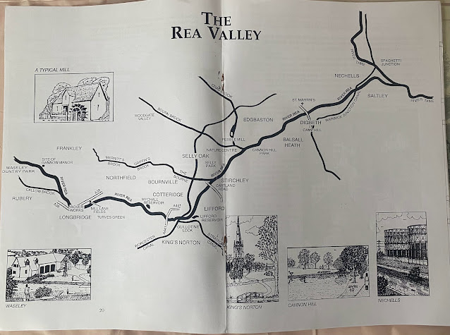
The source of the Rea springs from the slopes of the Waseley Hills in Worcestershire, before journeying in a north-westerly direction to join The Tame just south of Spaghetti Junction.
Harry takes us on a journey through time and space with poetic descriptions of memories and places along the river course, along with collected anecdotes of flooding and industries. He recounts the history and very beginnings of Birmingham when the Saxon tribe of 'Beorma' settled and made a home on the gentle slopes of the Rea near Digbeth and Deritend.
We shared experiences and our associations with rivers at the Pacha House meeting this week (15th March 2022). The Clyde, The Tyne and The Severn featured in our memories, swimming, crossing, gazing were all parts of our past associations with these magnificent waterways.
Roger Deakin in his book 'Waterlog', provides accounts of 'a swimmer's journey through Britain' and brought to our imaginations the adventures and perils of wild swimming. I've met a few wild swimmers since this book was published in 1999, their imaginations captured by Roger's audacious attempt to swim Britain, in the face of unknown obstacles, not least the weight of the law as well as health and safety commentators.
The Rea, whilst benign most times, also has treachery in its history trove, claiming many lives, the latest just a few weeks ago. It is a volatile body of water rising and falling quickly in accordance with rainfall and capture along its course between the Wasley Hills and the city centre. The surrounding urban developments aid the flooding process, causing grief to many, as their homes are inundated time and again. It is a much 'engineered' waterway, canalised and sunken by as much as 5-10 meters in places between Cannon Hill and Deritend.
WILDLIFE
 |
| From source to the confluence with the Tame |
WILDLIFE
 |
| The Rea by the MAC (sketch by Naima) |
There are many wildlife surprises to be discovered on a walk along the Rea. Whilst not renowned for its fish stocks, mainly because of extreme engineering in the past, destroying all semblance of habitat, it is nonetheless an important habitat for small fish and other aquatic feeding birds and mammals. There are mixed anecdotal accounts regarding the quantity and quality of fish in the Rea, but in recent years, the river has become home to birds such as Dipper and Little Egret, whilst Kingfisher and Heron have been residents for many years. Thus suggesting a healthy food chain.
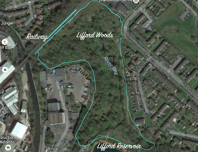
The wildest areas are to be found upstream of Cannon Hill Park
The water quality is generally good today- certainly compared to past years when pollution from factories, housing and farmland was once a constant factor contributing to the depletion of water oxygen, but recent improvements alongside better pollution detection and control, have included the removal of weirs and reforming of the river bed in places to allow better access for fish movements, spawning and feeding.
 |
| River Rea near Cannon Hill |
Arch of the Beorma Tribe
In 2002 Birmingham's medieval history was commemorated by the placement of a set of ornate rolled steel memorial arches in Gooch Street on a bridge over the River Rea in the suburb of Highgate by artist Steve Field, which reflects upon the foundation of the city and on modern Highgate's local identity. The memorial says "near this river crossing an Anglian tribe led by Beorma founded Birmingham". (Wiki)


Comments
Post a Comment