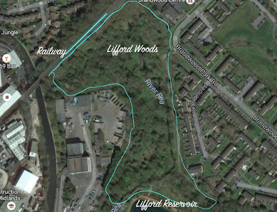
Habitat areas of importance along the Rea Valley between Cannon Hill Park and Dacer Close, Stirchley
RSPB Centenary Woodland
Location: Cannon Hill Park,
OS Reference SP 06646 83393,
Latitude 52.448458, Longitude -1.9036388
Activities between 2010-2014
Coppicing (Rangers and Volunteers)
Dead hedge management/habitat creation (Rangers, Volunteers)
Tree felling (Rangers, Volunteers and NIAB&BCWT
Tree planting (Rangers, Volunteers, NIAB&BCWT, Down To Earth)
Wildflower planting and seeding (NIAB&BCWT, Rangers)
Bird box scheme (Birmingham University)
Bird ringing scheme, (Birmingham University)
Footpath improvements (Rangers, Volunteers)
Active Parks Down To Earth (Rangers, Volunteers)
Wildlife surveying and recording (Rangers, Birmingham University, Volunteers, B&BCWT)
2015-
Active Parks Down To Earth (Environmental Education)
Bird ringing scheme (Birmingham University)
Bird box scheme (Birmingham University)
Wildlife surveying and recording (ECO Record)
For further details of RSPB/ Centenary Woodland please follow this link -
Stream and flush
Location: Cannon Hill Park
SP 06427 83512
Latitude 52.449535, Longitude -1.9068602
Activities between 2010 - 2014
swale creation (Rangers and Volunteers)
wetland planting (Rangers)
Hedgerow
Location: Cannon Hill Park
OS Reference SP 06389 83522
Latitude 52.449621, Longitude -1.9074261
Activities between 2010 - 2014
90 meters laid in 2010 (Rangers, Volunteers)
Re-growth monitored (Rangers)
Survey and recording (Rangers)
2015-
survey and recording (Rangers, Eco Record)
Large Meadow
Location: Rea Valley
OS Reference SP 06296 83344
Latitude 52.448018 Longitude -1.9087967
Activities between 2010 - 2014
Reinstatement following sewage filtration works (Contractor)
Re-seeding (Contractor)
Survey and recording (Rangers, OU Students)
Annual cut and collect (BPN)
Hay strewing (NIAB&BCWT)
Meadow management demonstration (Rangers, Brum Reapers, The Big Challenge, Volunteers)
2015 -
Survey and recording (Rangers and Volunteers)
Annual cut and collect (BPN)
Small Meadow
Location: Rea Valley
OS Reference SP 06277 83232
Latitude 52.447019 Longitude -1.9090784
Activities between 2010 - 2014
Cut and collect (Brum Reapers, BPN, chemical spray out prior to strewing)
Hay strewing (NIAB&BCWT, Volunteers)
2015
Cut and collect (BPN)
Survey and recording (Rangers, Eco Record)
Queen Mother’s Plantation
Location: Rea Valley
OS Reference SP 06243 83215
Latitude 52.446864 Longitude -1.9095799
Activities between 2010 - 2014
Tree thinning (NIAB&BCWT)
Coppicing (NIAB&BCWT)
Japanese Knotweed control (BPN)
2015
Tree planting (Rangers, Volunteers, NIAB&BCWT)
Wildflower planting and seeding (Rangers, Volunteers, NIAB&BCWT)
Coppicing (Rangers, Volunteers)
Holders Fields and Woods
Location: Rea Valley
OS Reference SP 406319 282784
Latitude 52.442991 Longitude-1.9084668
Activities between 2010 - 2014
Pool clearance (Friends of Fields & Rangers)
Coppicing (Rangers, Volunteers, Friends of Fields)
Bird box scheme (Birmingham University)
Bird ringing scheme, (Birmingham University)
Wildlife surveying and recording (Rangers, EcoRecord)
Plantation management (Rangers, Cockshutt Hill School)
Swale creation (Friends of Fields)
2015
Active Parks Down To Earth
Coppicing/Plantation management (Friends of Fields)
Bird box scheme (Birmingham University)
Bird ringing scheme, (Birmingham University)
Wildlife surveying and recording (Rangers, EcoRecord)
Highbury Park
Location
OS Reference
Latitude Longitude
Hazelwell
Location
OS Reference
Latitude Longitude


Comments
Post a Comment