Posts

Showing posts from September, 2022

Meadows and Pastures. The Cannon Hill Park Meadow

Image
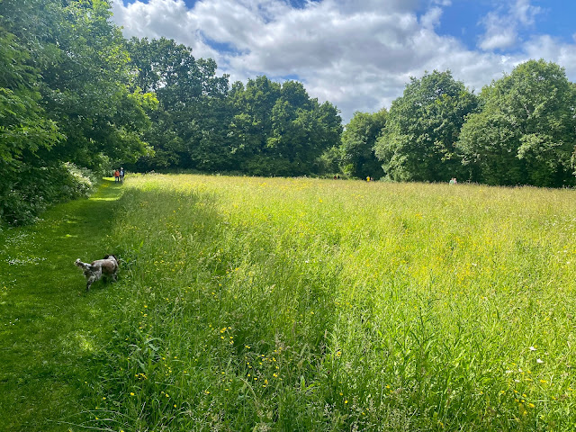
Meadows and pastures traditionally served the same purpose for feeding cattle and sheep throughout the year, pastures for all-year grazing and meadows providing hay for winter feeding, and these grassland features would have been an integral part of the city structure and development of the marketplace well into the 20th century. Many of our meadows are now managed for their wildlife value, maintained and enhanced on a single 'cut and collect' regime each year. By removing the nutrient-rich cuttings, the practice ensures a nutrient-poor soil layer, thus enabling a variety of flowering plants to thrive, rather than a coarse grass-dominated grassland.  Cannon Hill Meadow 2022 Highgate Park was Birmingham's first purchased municipal park, bought by the city council from a Trust set up at the request of the previous landowner Elizabeth Hollier in 1790, with an official acknowledgement by Mayor Joseph Chamberlain in 1876, three years after the opening of Cannon Hill Park. Up unt

Mediaeval Birmingham

Image
 Mediaeval Birmingham is one of 20 walks featured in this handy pocket booklet compiled by Archaeologist Dr Mike Hodder and Sue Whitehouse from Birmingham Museums Trust. It's an intriguing walk, and helps to establish a vision of Birmingham's mediaeval past with clarity and ease, combined with a few surprises. The ever changing nature of modern cities can soon render these descriptive walks obsolete, but in this case, the 1000+ year history maintains an existing and  centralised focus around St Martin's Church, with reference to nearby archaeological excavations. Mediaeval features mentioned - 1. Pinfold Street - part of the mediaeval road between Birmingham and Dudley 2. New Street - Temple Street crossroads, broadened at this point to form a market place in mediaeval times. 3. New Street - the site of the Guild Hall of The Holy Cross 4. Nelson monument - looking over the mediaeval market place next to St Martin's Church and the nearby  manor house  5. Mediaeval wallin

In Search of Old Birmingham - Where was the Market Hall?

Image
 Second walk 'In Search of Old Birmingham' with Down To Earth in The City Heritage Week 2022 - September 13th - Spiceal Street - The Bull Ring - High Street - Dale End Although the city centre we have in front of us today forms part of an ever-changing landscape with few features of old, we can still navigate the streets (mostly pedestrianised) with some familiarity of the early 19th and 20th Centuries.  2022 Looking south from Spiceal Street towards former  Jamaica Row (St Martin's on left) Some street names of old are still in use, and although the original wayside buildings may have changed beyond recognition, we can still visualise, with the aid of maps and images, the old Birmingham.  St Martin's Church, the Mother Church of Birmingham, becomes ever more fascinating the more we delve, the more we look, the more we see. A history dating back to mediaeval Birmingham, overlooking and perhaps overseeing everything and all the changes for many hundreds of years. From th

In Search of Old Birmingham

Image
A series of short walks starting from St Martin's Church, aided by maps,  images and brief historical accounts, together with memories and anecdotes. The aim is to provide visualisation, via 'down-to-earth means', involving walking, talking and a few old images of the city centre before the great 1960s destruction and also from our memories of the marketplace following the 1960s rebuild.  We're not making a timeline, so the dates will jump around a bit (but you can make one) Photo article from Birmingham History Forum The double rebuild, occurring within 40 years (loosely between the early 1960s and early 2000s), is quite dramatic, creating many anecdotes and conversations about the previous layouts, with buildings, roads and other landmarks disappearing during this period. However, two landmark features remain to provide a geographical reference from which we can locate many long-lost buildings and changing road layouts, the church and the Nelson statue. Walk 1 -  Moa